Mount Ramelau, officially known as Tatamailau (Tetum: Foho Tatamailau), is the majestic highest peak in Timor-Leste (East Timor) and the entire island of Timor. Standing as a beacon of natural beauty and profound spiritual significance, it is a challenging yet rewarding pilgrimage destination and a symbol of national identity.
Listen to an introduction about Mount Ramelau

Name: Mount Ramelau (Tetum: Foho Tatamailau, or Tatamailau; also Tata Mailau). Tatamailau means “Grandfather of All” in Mambai, a local language, while “Ramelau” refers to the mountain massif itself.
Address: The mountain is located approximately 70 kilometers (43 miles) south of the capital Dili, in the district of Ainaro, Timor-Leste. The primary starting point for most climbs is the mountain village of Hato Builico (also spelled Hatobuilico or Hatu Builico).
How to Get There:
Accessing Mount Ramelau requires travel from Dili, and road conditions can be challenging, especially during the wet season.
- By Air to Dili: International visitors typically arrive via Presidente Nicolau Lobato International Airport (DIL) in Dili.
- From Dili to Hato Builico (or Maubisse):
- 4WD Vehicle with Driver (Highly Recommended): This is the most practical and safest option due to the winding and often unpaved roads, particularly the final stretch to Hato Builico. The drive from Dili to Hato Builico can take upwards of 4-5 hours, with the last 18km to Hato Builico taking over 1.5 hours. Several Dili tour operators (e.g., Eco Discovery, Timor Adventures) organize trips.
- Public Transport: Local minibuses or shared taxis operate from Dili to Maubisse (a larger town about 1-2 hours before Hato Builico) and then onward to Hato Builico, but this can be slow and involves waiting for vehicles to fill up.
- Motorbike Rental: For experienced and adventurous riders, renting a motorbike in Dili is an option, but road conditions demand caution.
- From Hato Builico to the Summit:
- The trek to the summit usually begins very early in the morning (around 3:30 AM to 4:00 AM) to catch the sunrise.
- There are two main routes from the base: one from Hato Builico and another from Aimeta (which requires a local guide). The Hato Builico trail is well-formed, historically cut as a pilgrimage path.
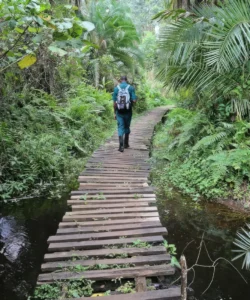
- Hiking: The ascent from Hato Builico to the summit takes approximately 2.5 to 4 hours, depending on fitness levels and conditions. It’s a steady climb, with the first half-hour consisting of stone steps, then turning into a dirt path.
- Local Guides: While the Hato Builico trail is relatively clear, hiring a local guide is highly recommended. They can provide cultural insights, assist with navigation (especially if paths split), and ensure safety.
- Permits/Fees: While no formal permits are usually required, it’s customary to inform the local community in Hato Builico of your intentions and sign a visitor book. A small donation to the local community (e.g., for guides) is appreciated.
- Best Time to Visit: The dry season (May to November) offers the best chance of clear views from the summit and better road conditions. The summit can be very cold, windy, and even freeze during the dry season, so warm clothing, a rain jacket, and sufficient water/food are essential.
Landscape and Architecture:
Mount Ramelau’s “architecture” is overwhelmingly natural, a result of ancient geological forces, but it also features significant spiritual landmarks that blend with the rugged terrain.
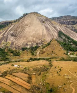
- Highest Peak in Timor-Leste: At 2,963 meters (9,721 ft), it is the highest point in Timor-Leste and the entire island of Timor.
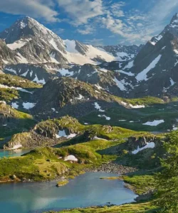
- Rugged Mountainous Terrain: The mountain is part of the Ramelau Mountain Range, a result of orogenic forces from the collision of Australian and Eurasian tectonic plates. The landscape is characterized by rugged, rocky terrain, steep slopes, and dramatic valleys.
- Diverse Vegetation: The lower slopes are often covered in eucalyptus woodland, dense green forest, and fertile areas used for coffee plantations and vegetable gardens (especially around Hato Builico and Maubisse). As you ascend, the vegetation becomes more alpine-like, with sparser flora closer to the summit.
- Volcanic Deposits and Limestone: The mountain itself is largely made of mafic volcanic deposits (Maubisse Formation), one of the oldest geological formations on Timor. Limestone outcrops also appear in the surrounding areas, creating diverse topographical reliefs.
- Panoramic Views: From the summit, especially at sunrise, visitors are treated to awe-inspiring 360-degree panoramic views of Timor-Leste. On clear days, the entire coastline can be visible, and the surrounding mountains roll out in every direction, casting long shadows.
- Statue of the Virgin Mary: Atop the summit platform stands a three-meter-high statue of the Virgin Mary (Nain Feto Ramelau / Our Lady of Ramelau). This alabaster statue was made in Italy and installed in 1997 during the Indonesian occupation, serving as a focal point for pilgrims.
- Open-Air Chapel: Approximately 500m below the summit, there is an open-air chapel, which has been rebuilt after being destroyed in 2020. This chapel is a significant site for religious masses and devotions during pilgrimages.
- Traditional Villages: Along the roads leading to the mountain, traditional thatched-roof villages with houses built of bamboo or mud walls can be spotted, offering glimpses of local Timorese life and architectural adaptations to the rural mountain environment.
What Makes It Famous:
- Highest Peak of Timor-Leste: Its status as the highest mountain in the country is its most direct claim to fame, making it a natural landmark and a trekking challenge.
- Pilgrimage Site to the Virgin Mary: Mount Ramelau is Timor-Leste’s most important Catholic pilgrimage site. Thousands of Timorese undertake annual pilgrimages to the summit, particularly on the Feast of the Annunciation (March 25th) or October 7th, to venerate the statue of the Virgin Mary. This deep religious significance is a defining characteristic.
- “Grandfather of All” (Ancestral Significance): Beyond its Catholic pilgrimage, the mountain holds profound pre-colonial ancestral and spiritual significance for the indigenous Timorese people, known as Tatamailau (“Grandfather of All”). It’s believed to be the home of ancestors’ souls and a place for rituals, symbolizing the continuity of indigenous beliefs alongside Catholicism.
- Spectacular Sunrise Views: The arduous pre-dawn hike to witness the sunrise from the summit, with the entire nation seemingly unfurling below, is an unforgettable experience and a major draw for both religious and non-religious visitors.
- Symbol of Resilience and Hope: During the Indonesian occupation, Mount Ramelau served as a strategic base for FALINTIL guerrilla fighters, becoming a symbol of resistance and resilience for the Timorese people in their fight for independence.
- Untouched Natural Beauty: It offers a raw, unspoiled natural beauty, with diverse flora and fauna (including endemic bird species) and panoramic views of a largely untouched landscape.
- Accessible Trekking Challenge: While requiring fitness and a challenging journey to reach the base, the hike to the summit itself is considered of moderate difficulty, making it accessible to a wider range of trekkers than some extreme mountaineering peaks.
Differences from Some Other Wonders:
- Highest Point of a Young Nation with Deep Spiritual Layers: While other mountains are high (Himalaya, Mount Kinabalu), Ramelau’s fame is tied to being the highest peak of a relatively young, post-conflict nation, deeply imbued with a unique blend of traditional ancestral animism and a strong Catholic faith, a syncretism visibly expressed in its summit statue and pilgrimage rituals. This specific cultural-historical-religious layering is distinct.
- Emphasis on Pilgrimage: Unlike many mountains that are primarily for adventure trekking or scenic viewing, a significant portion of Ramelau’s visitors undertake the climb as a religious pilgrimage, which influences the atmosphere and interactions on the trail.
- Rugged, Underdeveloped Access: Compared to well-established trekking routes with lodges (like parts of the Himalaya) or well-paved roads, Ramelau’s approach often involves challenging, unpaved roads requiring 4WDs and reliance on local communities for guidance, reflecting Timor-Leste’s developing tourism infrastructure.
- Statue on Summit: The prominent statue of the Virgin Mary on the very summit is a defining architectural and spiritual landmark that is central to the mountain’s identity, a specific religious marker not found on many other high peaks.
- Less Focus on Large Wildlife: While it’s an Important Bird Area, Ramelau’s primary appeal is not for specific large mammal viewing or vast biodiversity exploration like some national parks (e.g., Komodo National Park, Atauro Island for marine life, or Jim Corbett for tigers). Its natural draw is its elevation and views.
- Historical Significance in Recent Conflict: Its active role as a guerrilla base during the Indonesian occupation gives it a very direct and recent historical significance related to national liberation, a narrative less common for ancient wonders or purely natural sites.


