Sagarmatha National Park, located in the Himalayas of northeastern Nepal, is a truly iconic natural wonder that holds the “roof of the world” within its boundaries. It’s renowned for its dramatic mountain scenery, unique high-altitude ecosystems, and the rich cultural heritage of the Sherpa people.
Name: Sagarmatha National Park (Nepali: सगरमाथा राष्ट्रिय निकुञ्ज, Sagarmatha Rastriya Nikunj; “Sagarmatha” is the Nepali name for Mount Everest, meaning “forehead in the sky”)
Address: Solukhumbu District, Koshi Province, Nepal. The park encompasses the upper catchment areas of the Dudh Kosi and Bhote Koshi rivers. Its lowest point is Monjo (at 2,845 meters / 9,334 feet), and it extends to the summit of Mount Everest (8,848.86 meters / 29,031.7 feet) in the north. The main trekking hub and significant Sherpa village within the park is Namche Bazaar.
How to Get There:
Access to Sagarmatha National Park is primarily by air and then trekking, as there are no direct road connections into the core park area.
- By Air to Lukla (Tenzing-Hillary Airport – LUA): This is the most common and preferred way.
- Fly from Kathmandu (KTM) or Manthali Airport in Ramechhap (Ramechhap is often used during peak season to manage Lukla traffic) to Lukla. The flight is short (around 25-35 minutes) but can be prone to delays or cancellations due to unpredictable mountain weather.
- Lukla is widely considered the “gateway to Everest” and the entry point for the Sagarmatha National Park.
- By Helicopter: Helicopter flights are available from Kathmandu directly to Lukla, or even to higher points like Everest Base Camp or Kala Patthar, offering a faster and more luxurious (but expensive) option, often used by those with limited time or who prefer to avoid the full trek.
- By Road + Trek (Longer & More Challenging):
- Take a bus or jeep from Kathmandu to Jiri (about 100 km away) and then embark on a long trek of approximately 10 days to reach the park.
- Alternatively, travel by bus to Salleri (or Phaplu, which has an airport), and then trek for about 5 days to reach the park.
- Within the Park: The park has no internal road access. All exploration within Sagarmatha National Park is done on foot (trekking). Well-established trekking routes lead to various villages, viewpoints, and base camps. Porters and yaks/dzos are used to transport goods.
- Park Entry Permit: Visitors must purchase an entry permit at the entrance gate in Monjo, near Namche Bazaar. Trekking permits (TIMS card) are also required for the overall Everest region.
- Best Time to Visit: The best times are during the spring (March to May) and autumn (September to November) seasons. The weather is generally stable, offering clear views of the mountains. Spring also sees rhododendrons in bloom. Winter (December to February) is very cold but can offer exceptionally clear skies. Monsoon (June to August) brings heavy rains, clouds, and leeches, making trekking challenging.
Landscape and Architecture:
Sagarmatha National Park’s “architecture” is overwhelmingly natural, dominated by towering Himalayan peaks, vast glaciers, and deep river valleys, complemented by the unique, adapted traditional Sherpa settlements.
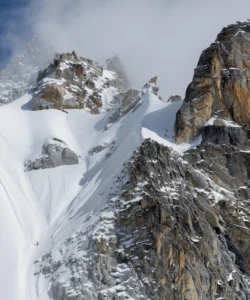
- World’s Highest Peaks: The park is centered around Mount Everest (Sagarmatha), the highest peak on Earth (8,848.86 m / 29,031.7 ft). It also encompasses seven other peaks over 7,000 meters (23,000 ft), including Lhotse (8,516 m), Nuptse (7,861 m), Cho Oyu (8,188 m), Ama Dablam (6,812 m), Thamserku, and Pumori. These majestic, snow-capped giants create a dramatic and awe-inspiring landscape of unparalleled beauty.
- Glaciers and Glaciated Valleys: A significant portion of the park consists of glaciers (such as the Khumbu Glacier, Ngozumpa Glacier, and Imja Glacier) and deep, U-shaped glacial valleys carved by ancient ice. These glaciers feed the park’s major rivers, Dudh Kosi and Bhote Koshi.
- Dramatic Altitudinal Range: The park’s elevation spans over 6,000 meters, from temperate and subalpine forests at lower altitudes to alpine meadows, barren land, and permanent snow/ice zones at higher elevations. This rapid change in altitude creates a remarkable diversity of ecosystems.
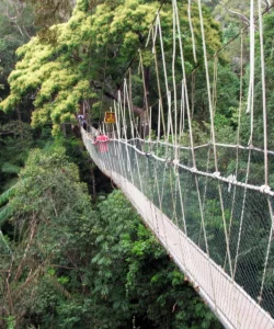
- Rivers and Gorges: The Dudh Kosi and Bhote Koshi rivers carve deep gorges through the rugged terrain, forming a vital network of waterways that support diverse flora and fauna. Numerous suspension bridges crisscross these rivers, a common feature of the trekking routes.
- Sherpa Villages and Traditional Architecture: The park is home to over 20 traditional Sherpa villages, with a population of over 6,000 people. Their architecture is adapted to the harsh mountain environment, often featuring stone houses with slate roofs, built close together for warmth and community. Villages like Namche Bazaar, Khumjung, and Tengboche are significant cultural hubs.
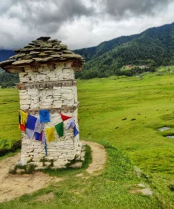
- Buddhist Monasteries (Gompas) and Stupas: The Sherpa people are devout Buddhists, and the landscape is dotted with numerous ancient and active Buddhist monasteries (gompas), traditional stupas (chortens), prayer walls (mani walls), and colorful prayer flags (lungta). Tengboche Monastery is the largest and most significant monastery in the Khumbu region, offering stunning views of Everest and Ama Dablam.
- High-Altitude Lakes: The park features beautiful high-altitude glacial lakes, most famously the Gokyo Lakes system, which are considered sacred and attract both pilgrims and trekkers.
What Makes It Famous:
- Home to Mount Everest: It is globally renowned as the location of Mount Everest (Sagarmatha), the world’s highest peak, making it the ultimate destination for mountaineers and a bucket-list trek for adventurers (Everest Base Camp Trek).
- UNESCO World Heritage Site: Designated a UNESCO World Heritage Site in 1979, Sagarmatha National Park is recognized for its “superlative natural phenomena” (dramatic mountains, glaciers, deep valleys) and its unique cultural heritage (the Sherpa people).
- Exceptional Natural Beauty: The park offers awe-inspiring scenery, including some of the most dramatic mountain landscapes on Earth, with towering snow-capped peaks, vast glaciers, and rugged valleys.
- Unique Sherpa Culture: The strong cultural heritage of the Sherpa people, their unique adaptation to high-altitude living, their Buddhist faith (evident in monasteries and spiritual sites), and their integral role in mountaineering expeditions, are a defining aspect of the park’s fame.
- Biodiversity of High-Altitude Ecosystems: Despite its extreme altitude, the park supports a surprising diversity of flora (over 1,000 species) and fauna, including rare and endangered species like the snow leopard, red panda, Himalayan tahr, and musk deer. It is also an Important Bird Area.
- World-Class Trekking Destination: It hosts some of the most famous trekking routes in the world, including the Everest Base Camp Trek, Gokyo Lakes Trek, and the Everest Three High Passes Trek, attracting thousands of trekkers annually.
- Geologically Young and Active Mountains: The Himalayas are a relatively young and geologically active mountain range, still rising due to ongoing tectonic plate collision, adding a dynamic geological element to the park.
Differences from Some Other Wonders:
- Highest Peaks and Extreme Altitude: While other wonders might be mountainous (e.g., Mount Kinabalu, Mount Rinjani, Himalayas broadly), Sagarmatha National Park uniquely encompasses the highest peak in the world (Mount Everest) and a concentration of other 8,000-meter peaks within its boundaries. Its extreme altitudinal range (over 6,000m) and the associated challenges (altitude sickness) are defining features.
- Integrated Natural and Cultural Landscape (Sherpa Identity): While other national parks might have local communities, Sagarmatha’s UNESCO designation explicitly highlights the “intricate linkages of the Sherpa culture with the ecosystem” as a core World Heritage value. The Sherpa people’s unique way of life, Buddhist traditions, and historical role as mountaineering experts are inseparable from the park’s identity, making it a unique cultural-natural blend.
- Glacial Systems and Their Impact: The park contains some of the world’s largest glacial systems outside the poles (Khumbu, Ngozumpa), which are actively shaping the landscape and creating new glacial lakes (e.g., Imja Lake), making it a site for studying climate change impacts in high mountains.
- Trekking-Only Access: Unlike many national parks that allow vehicle safaris (e.g., Jim Corbett, Sundarbans) or extensive road networks, the entire Sagarmatha National Park experience is primarily on foot (trekking), which provides an immersive, physical, and authentic high-mountain adventure.
- Unique Challenges for Visitors: The high altitude, risk of Acute Mountain Sickness (AMS), and reliance on lodges along the trekking route create a specific set of challenges and experiences for visitors that are distinct from other, lower-altitude parks or historical sites.
- Buddhist Monastery Integration (Tengboche): The presence of prominent and active Buddhist monasteries like Tengboche, offering spiritual retreats and cultural insights amidst the towering peaks, adds a unique spiritual dimension.
- Qomolangma National Nature Preserve Border: It shares a direct border with China’s Qomolangma National Nature Preserve, forming a larger transboundary protected area of the highest mountains on Earth.
Sagarmatha National Park Photos:


