Irrawaddy River


The Irrawaddy River, also known as the Ayeyarwady River, is truly the “lifeline” and “bloodline” of Myanmar. Flowing from its source in the Himalayan glaciers of northern Myanmar all the way south to the Andaman Sea, this colossal river is the country’s most important commercial waterway, cultural artery, and an indispensable part of Burmese identity.

Name: Irrawaddy River (Burmese: ဧရာဝတီမြစ်, Ayeyarwady Myit; sometimes referred to as ‘The Road to Mandalay’ after Rudyard Kipling’s poem)
Address: The Irrawaddy River flows through the entire length of Myanmar, bisecting the country from north to south. Its source is in Kachin State, at the confluence of the N’mai and Mali Rivers, and it empties into the Andaman Sea through the vast Irrawaddy Delta.
How to Get There:
Experiencing the Irrawaddy River is typically done as part of a longer Myanmar itinerary, often via river cruises or visiting cities along its banks.
- By Air: Most visitors fly into major cities like Yangon (RGN) or Mandalay (MDL). From these cities, you can connect to river cruises or visit riverside towns. Heho Airport (HEH) for Inle Lake and Nyaung-U Airport (NYU) for Bagan are also common entry points for river journeys.
- By River Cruise (Recommended): This is the most iconic and immersive way to experience the Irrawaddy. Various cruise operators (from basic local boats to luxurious riverboats like Sanctuary Ananda, RV Pandaw, or Belmond Road to Mandalay) offer itineraries:
- Mandalay to Bagan (and vice versa): The most popular route, usually 1-3 nights, offering a scenic journey past traditional villages, pagodas, and rural life.
- Longer Cruises: Some cruises travel further upstream (e.g., from Yangon to Mandalay via Pyay, or even to Bhamo near the Chinese border) or explore its major tributary, the Chindwin River.
- By Local Boat/Ferry: For more budget-conscious travelers or shorter segments, local public ferries operate between various riverside towns, providing an authentic glimpse into daily riverine life.
- By Road/Train: Many of the cities and towns along the Irrawaddy are accessible by road and train from other parts of Myanmar, allowing you to visit specific points of interest.
Landscape and Architecture:
The Irrawaddy’s landscape is incredibly diverse, changing dramatically as it flows from the high Himalaya to the sea, and its “architecture” is deeply intertwined with Burmese history, culture, and daily life.
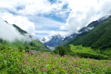
- Source in Himalayan Glaciers: The river originates from the confluence of the N’mai and Mali Rivers, both fed by Himalayan glaciers in remote northern Myanmar near the border with Tibet. This region features thick evergreen rainforests, transitioning to oak, pine, and rhododendron forests at higher elevations.
- Steep Gorges and Turbulent Waters (Upper Reaches): In its upper stretches (north of Bhamo), the river cuts through spectacular gorges with fast, turbulent waters, often unnavigable.
- Central Basin and Lowlands: Teak Forests and Fertile Plains: As it flows south, the river widens and meanders through the vast, flat plains of Myanmar’s central basin. This area was historically rich in teak forests and is now extensively used for agriculture, particularly rice cultivation, due to its fertile alluvial soil. The landscape is characterized by open plains, dotted with small towns and villages.
- Irrawaddy Delta: The southernmost part of Myanmar is dominated by the immense Irrawaddy Delta, a low-lying, extremely fertile region where the river branches out into nine main distributaries before emptying into the Andaman Sea. This delta features mangroves, freshwater swamp forests, marshes, oxbow lakes, and islands. It is a major rice-growing area (Myanmar’s “rice bowl”).
- Riverside Pagodas and Stupas: The banks of the Irrawaddy are home to countless Buddhist pagodas, stupas, and monasteries, particularly around ancient capitals like Bagan, Mandalay, Sagaing, and Mingun. These range from the gilded splendor of the Shwedagon Pagoda (in Yangon, near the delta) to the thousands of brick temples scattered across the Bagan plains. This ubiquitous religious architecture reflects the omnipresence of Buddhism in Burmese life.
- Traditional Riverine Villages and Stilt Houses: Along the riverbanks, traditional villages with houses built on stilts (especially in the delta region, adapting to seasonal flooding) or simple wooden dwellings dot the landscape. Life in these villages revolves around the river.
- Colonial Architecture: In cities like Mandalay, Pyay, and particularly Yangon (on the eastern branch of the delta), you can find remnants of British colonial architecture, including grand buildings and administrative structures from the colonial era.
- Traditional Boats and Rivercraft: The river is alive with a wide array of traditional Burmese rivercraft – long wooden cargo boats, passenger ferries, small canoes, and fishing boats, all essential to local commerce and transport.
- U Bein Bridge (Mandalay): While not on the Irrawaddy itself, the iconic U Bein Bridge (the world’s longest teak wooden bridge, in Amarapura near Mandalay) is a famous architectural landmark often associated with the river, providing stunning sunset views across Taungthaman Lake, which connects to the Irrawaddy during high water.
What Makes It Famous:
- Lifeline of Myanmar: The Irrawaddy is the most important river in Myanmar, serving as the country’s economic lifeblood, primary transportation route for goods (rice, petroleum, teak logs) and people, and an indispensable source of irrigation for agriculture. It’s often called the “Mother River” of Myanmar.
- Cultural and Historical Artery: For centuries, the Irrawaddy Valley has been the heartland of Burmese civilization, home to successive royal capitals (Bagan, Mandalay, Inwa, Sagaing, Amarapura) and countless ancient pagodas and monasteries. It has shaped Burmese history, culture, and identity.
- Irrawaddy Dolphin: The river is home to the critically endangered Irrawaddy dolphin (Orcaella brevirostris), a unique freshwater dolphin species known for its rare and fascinating cooperative fishing behavior with local fishermen, where dolphins help to herd fish into nets.
- River Cruises: Experiencing the river on a multi-day cruise, particularly between Mandalay and Bagan, is a world-renowned way to witness Myanmar’s timeless landscapes, ancient temples, and traditional riverside life.
- Iconic Scenery: The ever-changing scenery, from the rugged mountains in the north to the sprawling delta in the south, dotted with thousands of temples in places like Bagan, offers unparalleled picturesque views, especially during sunrise and sunset.
- Biodiversity: The Irrawaddy River Landscape is considered a biodiversity hotspot within the Indo-Burma region, supporting over 1,400 mammal, bird, and reptile species, including endangered ones like tigers, Asian elephants, and various fish species, many endemic to the river basin.
- Spiritual Significance: The river is deeply ingrained in the spiritual life of the Burmese people, with numerous sacred sites along its banks and traditions like river baptisms.
Differences from Some Other Wonders:
- “Lifeline” Status for an Entire Nation: While other rivers are important (e.g., the Mekong for Southeast Asia), the Irrawaddy’s specific and profound role as the singular “lifeline” and primary artery (commercial, cultural, historical) for the entire nation of Myanmar, given its geography and historical development, sets it apart.
- Cooperative Dolphin-Fishermen Interaction: The unique and rare symbiotic relationship between the Irrawaddy dolphins and local fishermen, where they actively cooperate in fishing, is a distinct cultural and ecological phenomenon not seen in other major rivers.
- River as a “Linear Museum”: Unlike a single, concentrated archaeological site (like Angkor Wat or Borobudur), or an urban center, the Irrawaddy acts as a linear “museum,” connecting and showcasing centuries of Burmese history, architecture, and culture spread along its vast length, best explored via multi-day cruises.
- Lack of Major Bridges: Despite its immense importance, the Irrawaddy historically had relatively few bridges along its length until recent decades, with river crossings being primarily by ferry or traditional boats, which highlights its unique role as a natural barrier and highway.
- Directly Shaped Multiple Ancient Capitals: Unlike rivers that might pass near a capital, the Irrawaddy directly shaped and served as the artery for multiple successive ancient Burmese capitals (Bagan, Mandalay, Inwa, Sagaing, Amarapura), making its historical connection exceptionally deep.
- Unique Deltaic Agriculture: Its vast and fertile delta, where unique rice-growing practices are sustained by the river’s seasonal flooding, is a major “rice bowl” that underpins the country’s economy.
- No Dams in Mainstream (Historically): Until recently, the mainstream Irrawaddy was largely free-flowing, distinguishing it from many other major rivers globally that are heavily dammed. However, the controversial Myitsone Dam project (at its source) remains a significant environmental and cultural concern.
Location on world map